|
If you enjoy hiking, but you are not an expert this post will be for sure something you need to read if in Mendoza, Argentina (and probably also in Santiago de Chile) and you want to hike (a bit of) Aconcagua. I'll share the trip and all relevant details based on my experience on the trail.
I did not enjoy hiking so much back in the days. I was always breathing hard, being too hot or too cold, it was not something that i was eager to do till when I realized that hiking is not about speed or being the first up to the top, but about getting in balance with yourself. A hike is never too hard if you know your limits and listen to your body. In my posts you'll see different hiking trails, but all of them will be easy or moderate ones. So if I can do it, you can do it!
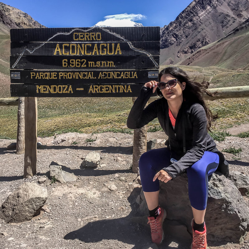
"Who" is this Aconcago mountain?
"Aconcagua, is the highest mountain outside of Asia, being the tallest in both the Southern and Western Hemispheres with a summit elevation of 6,960.8 metres (22,837 ft). It is located in the Principal Cordillera of the Andes mountain range, in the Mendoza Province, Argentina, and lies 112 km (70 mi) northwest of its capital, the city of Mendoza, about five km (3.1 mi) from San Juan Province and 15 km (9.3 mi) from the international border with Chile. The mountain itself lies entirely within Argentina, immediately east of Argentina's border with Chile." (Source)
Before you leave towards Aconcagua:
FOOD:
During a hike you consume a lot of energy, make sure you have with you some protein bars, nuts and maybe a banana or so and of course water. CLOTHES:
Getting there from Mendoza
I will start with: LEAVE EARLY! I know it's hard to wake up and all, but you'll be happy that you listen to me and all the other hikers recommending the same :)
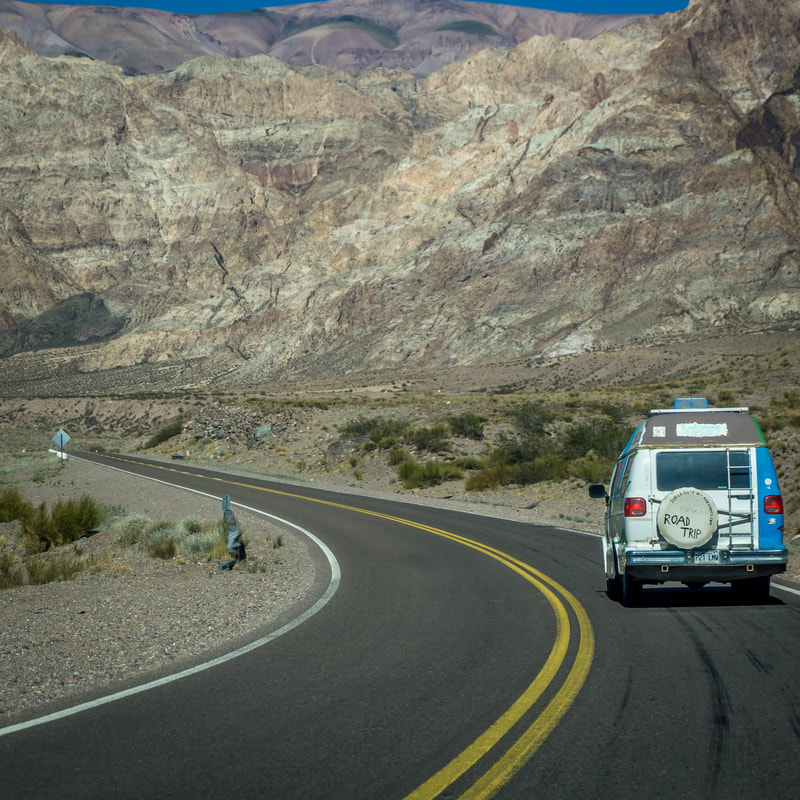
By CAR: if you have a car, then it is super easy. Hop in the car early in the morning, enjoy the ride through the beautiful landscape and following Route 7 till about 15 km from the border with Chile you'll see the entrance of the Parque Provincial Aconcagua.
By Bus: You can check the schedules from Menodza over HERE
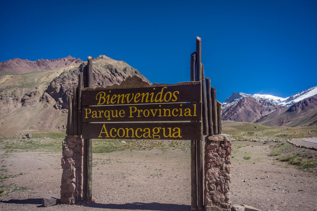
Registration Prior to the Hike
Once you have entered the park, park you car and go into the small white building where you can register your arrival. This is mandatory. Please make sure you have an identification document along, I am not sure that the passport is mandatory but I would recommend having this as a document with you.
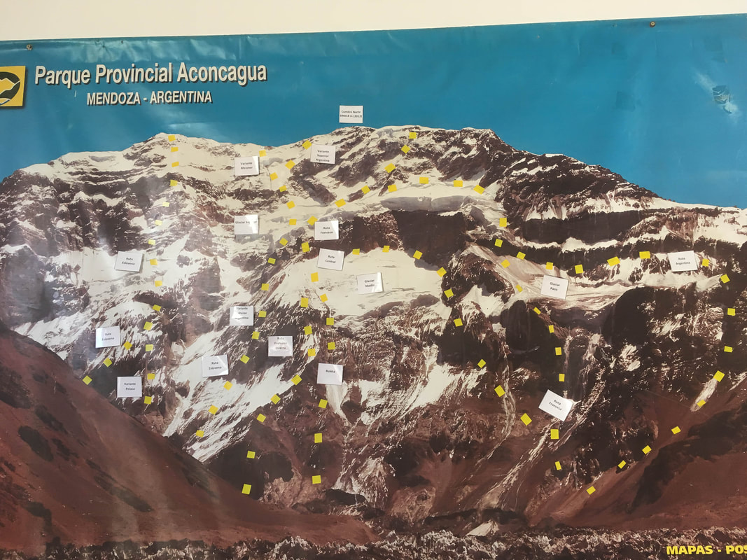
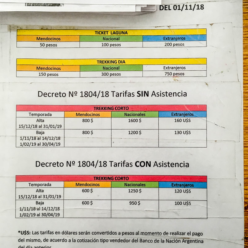
You have 3 permit types:
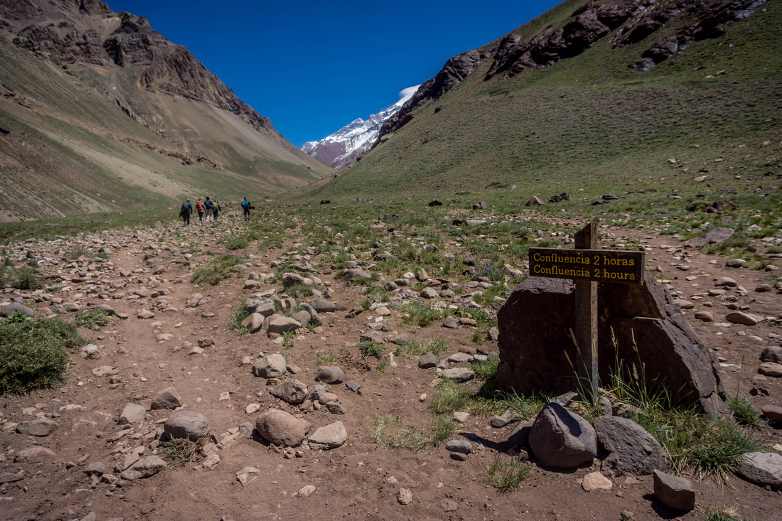
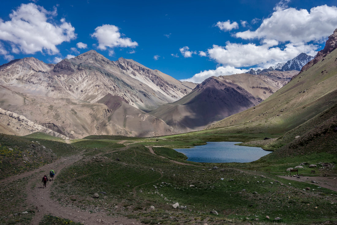
Hiking up to Confluencia
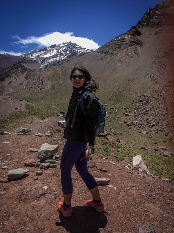
You start hiking at 2800 m which for some might already be causing hard breathing (due to having less oxygen) and you will end up to 3300 m. What I can recommend based on my own experience is to go on your own pace, you don't have to keep up with the fastest of your group, you can't get lost so no worries for that. If you want to stick together ask the slowest hiker to go first and determine the rhythm. We needed about 4.5 h for the hike (parking to parking) which i guess is average. As feedback i got from my sister is that for her (a runner, but not used to the altitude) the hardest part was breathing which slowed her down a lot.
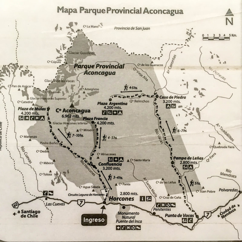
Circuito Laguna Horones
This is the short hike, which you can see in the big map as a triangle :). I think is a cute stop to see how impressive this mountain really is and the moment for your first selfie (or group photo).
Going further to Confluencia
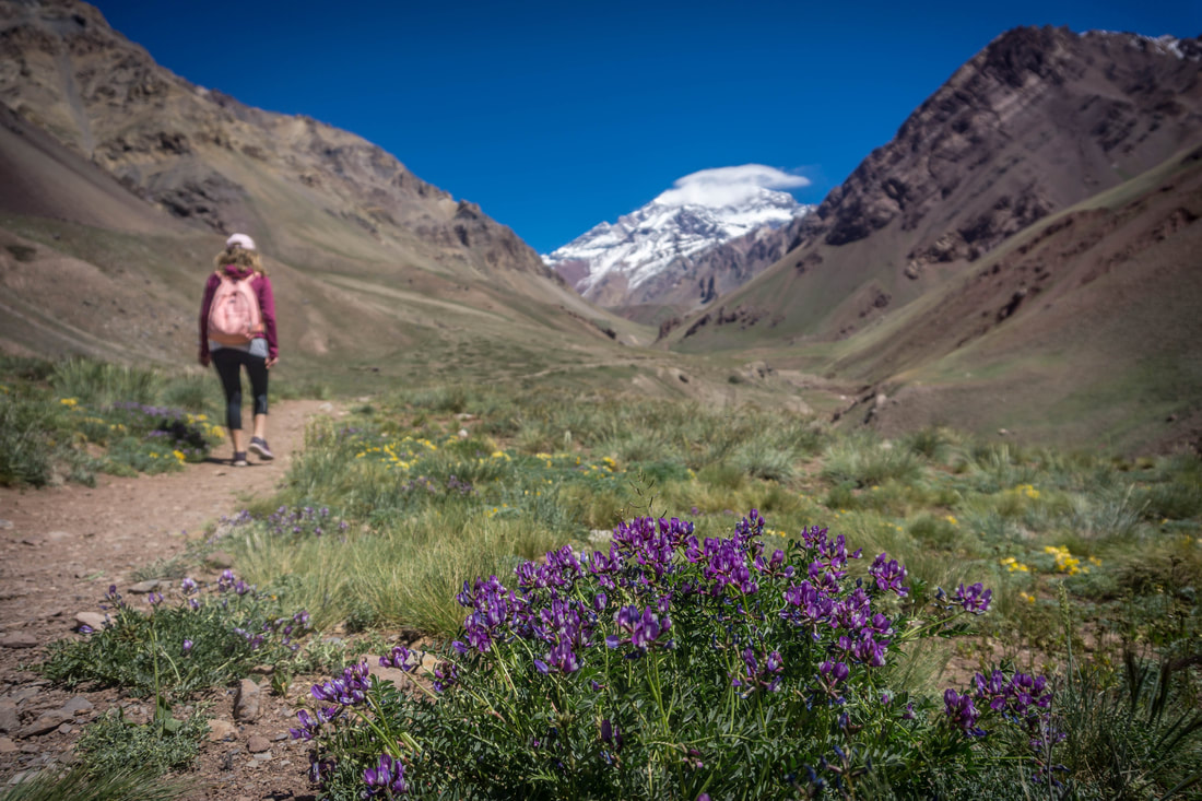
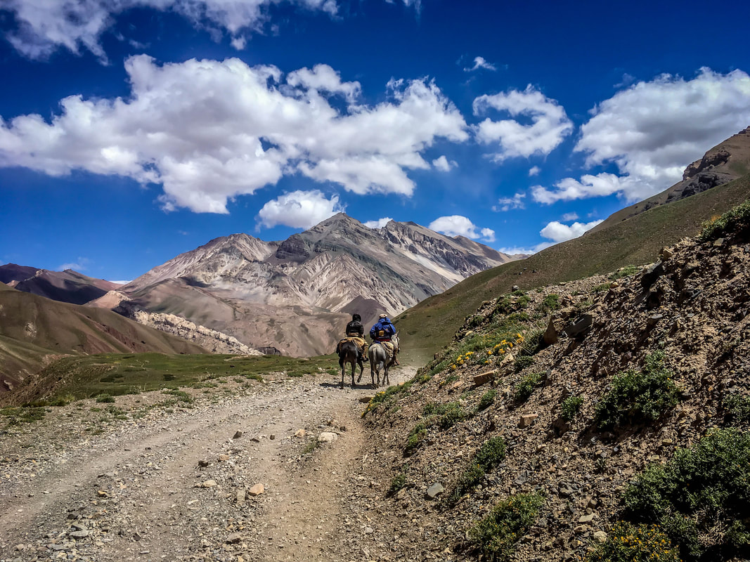
You will get several signs on the way to stay on track, plus make sure you follow the rest of the hikers. I will add some pictures here to see a bit what to expect of how the ground looks like.
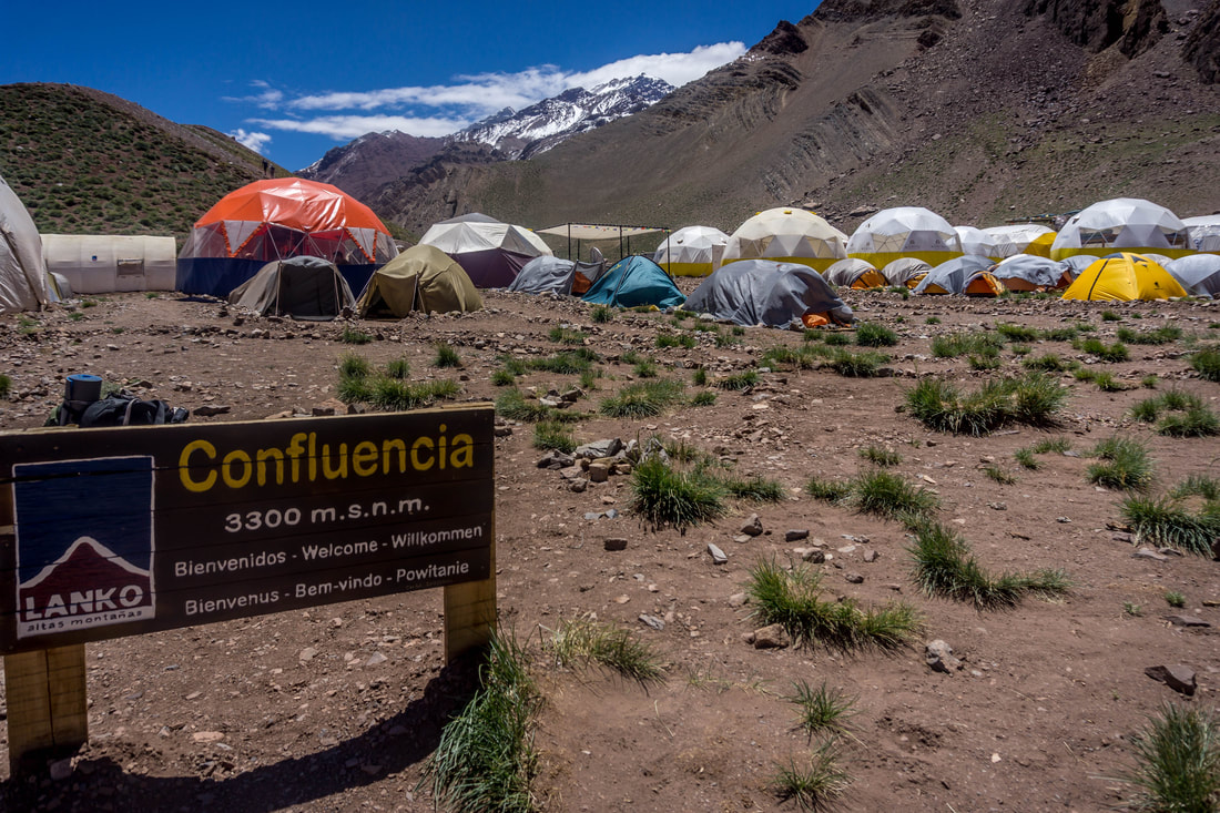
Reaching Confluencia
We went there early January so the base camp was populated. When you reach the base camp you need to inform the park authorities that are staying in a small cabin right at the beginning that you arrived as they need to make sure they keep an eye on all people going for the hike.
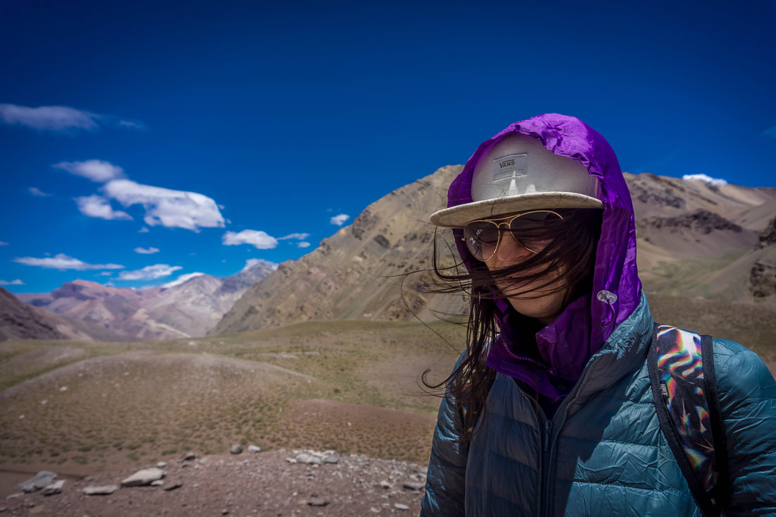
It was super cold, actually the wind was making everything hard to cope with. We could get warm a few minutes in one of the places organized for the campers. Then we decided to make the hill up and take a nice picture of our accomplishment. I could barely stand :)
You also have toilets here, so it's a good moment to take advantage of that. Then we started our way back not before taking a selfie with the Confluencia Sign. Anyway here some extra picture from the road.
Return to the car
Going back was far easier, although keep an eye on the road as it can get slippery (the small stone ground here and there). At the end we stopped at Laguna Horcones just for my sister to show off that she could resist now in sleeveless top :)
Take the car from the parking at the beginning at the train and stop again at the parking where you got your permit. You need to inform you arrived back safe.
Puente del Inca
If you still have enough energy (on top of what you need for driving), stop at Puente del Inca which is a natural arch that forms a bridge over the Las Cuevas River, a tributary of the Mendoza River
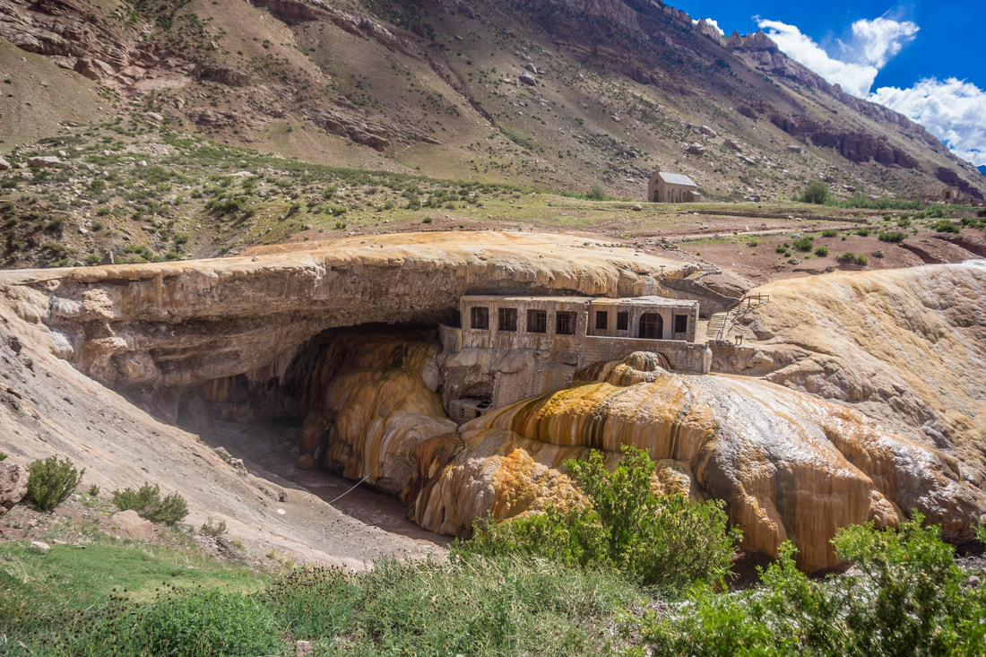
They have several souvenir shops and a place where you can get a hot cup of tea and use the toilets.
At the end of the day my FitBit said 31.324 steps with a total of 21.11 km; 228 minutes of activity & 3179 calories burned. - Not bad :)
Note: Before the trip, what I found best as source the information was the blog post of Earth Trekekrs
1 Comment
|
Categories
All
Archives |
 RSS Feed